2026 AIRBORNE
GEOPHYSICAL SURVEY.
In August 2026 a helicopter-borne MobileMT electromagnetic and magnetic survey covered the 19 km² Ajax block with 230 line-kilometres of data. The contractor's report, its maps and sections, the full dataset and an interactive 3D model are below.
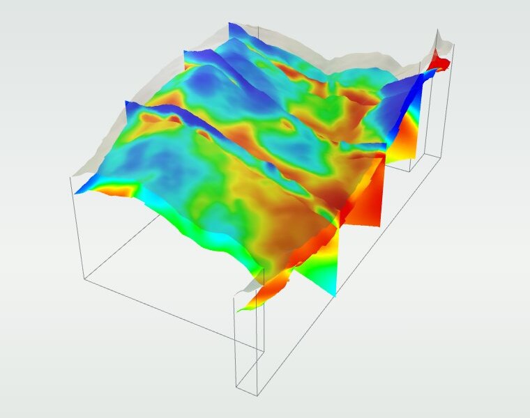
Three map layers, thirteen depth slices and three sections through the historical drilling, with the resistivity volume in 3D. Start with the guided tour, or open the map full screen.
 OPEN THE INTERACTIVE MAP ↗
Opens full screen, with the guided tour, thirteen depth slices, three sections and the 3D model.
The helicopter-borne MobileMT electromagnetic and magnetic survey over the Ajax block for Korestar Exploration Inc. was successfully completed, covering 230 line-km across 19 km². All planned lines were acquired and validated through field and office quality control. The survey produced high-quality broadband electromagnetic, VLF, and magnetic data, providing consistent coverage and reliable inversion results.
The main digital products in the result of the survey include databases, voxel, sections, depth slices, grids, geotiffs, and maps of resistivity, apparent conductivity, VLF amplitudes, and magnetic products. All inputs referenced above are provided in the final deliverables for immediate use in GIS/Geosoft workflows. All pictures in the report are presented as examples, the full set of digital data follow the report in corresponding files and archives.
The main geophysical survey goals at Ajax Block achieved:
- Successful delineation of the principal conductive and resistive geophysical domains within the Ajax survey area through the integration of MobileMT resistivity, apparent conductivity, magnetic, and VLF datasets. The survey improved the understanding of lithological variability, intrusive contacts, and possible alteration-related geoelectrical contrasts associated with the local volcanic-sedimentary and intrusive rock packages.
- Integration of apparent conductivity, resistivity inversion, and magnetic data identified multiple conductivity gradients, resistivity contrasts, and structurally complex zones that may reflect lithological contacts, faulting, hydrothermal alteration, and sulphide-bearing geological units. Several of these features occur within areas of historical exploration activity and provide valuable constraints for follow-up geological interpretation and target evaluation.
- The 2.5D Mare2DEM inversion results and the derived 3D resistivity voxel model improved the understanding of the geometry and depth extent of subsurface resistivity features within the surveyed area. While the survey coverage is limited and does not permit confident interpretation of property-scale structural trends, the results successfully highlighted several local areas of interest characterized by significant resistivity contrasts and structural complexity that warrant further investigation.
Overall, the survey successfully achieved its objective of providing high-resolution geophysical data to support exploration targeting within the survey block. The dataset highlights multiple anomalies that warrant further investigation, but additional work is required to assess their potential association with alteration zones or mineralization.
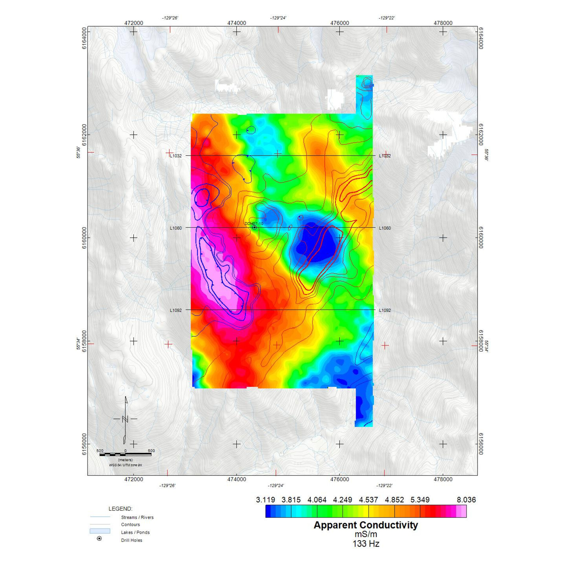
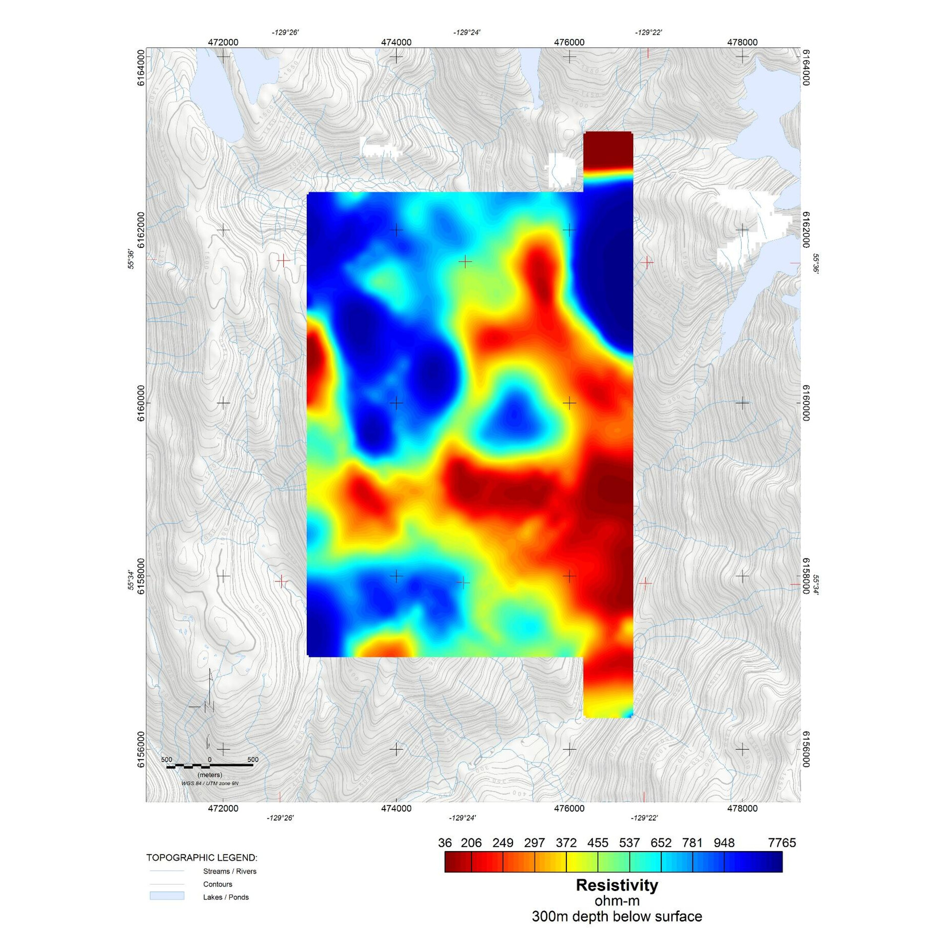
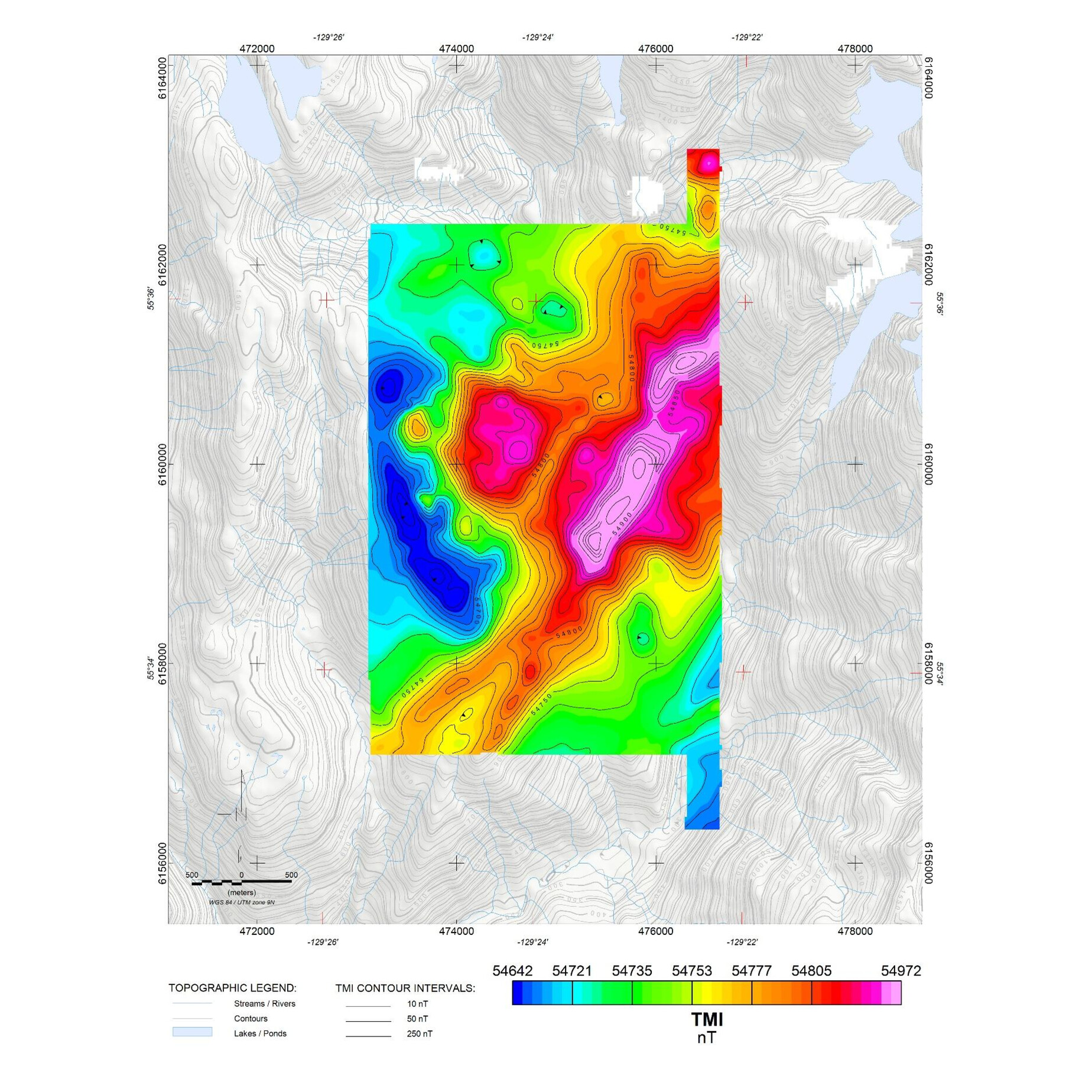
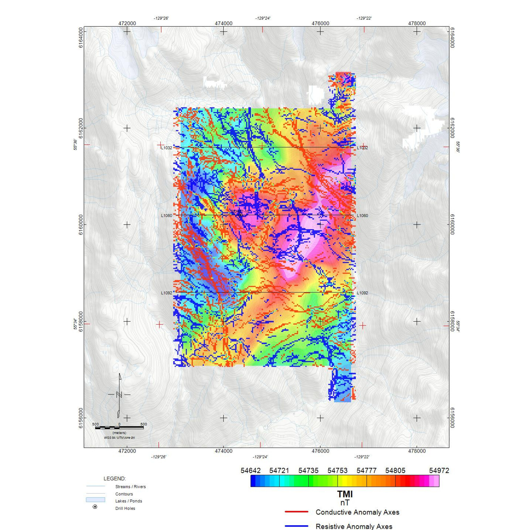
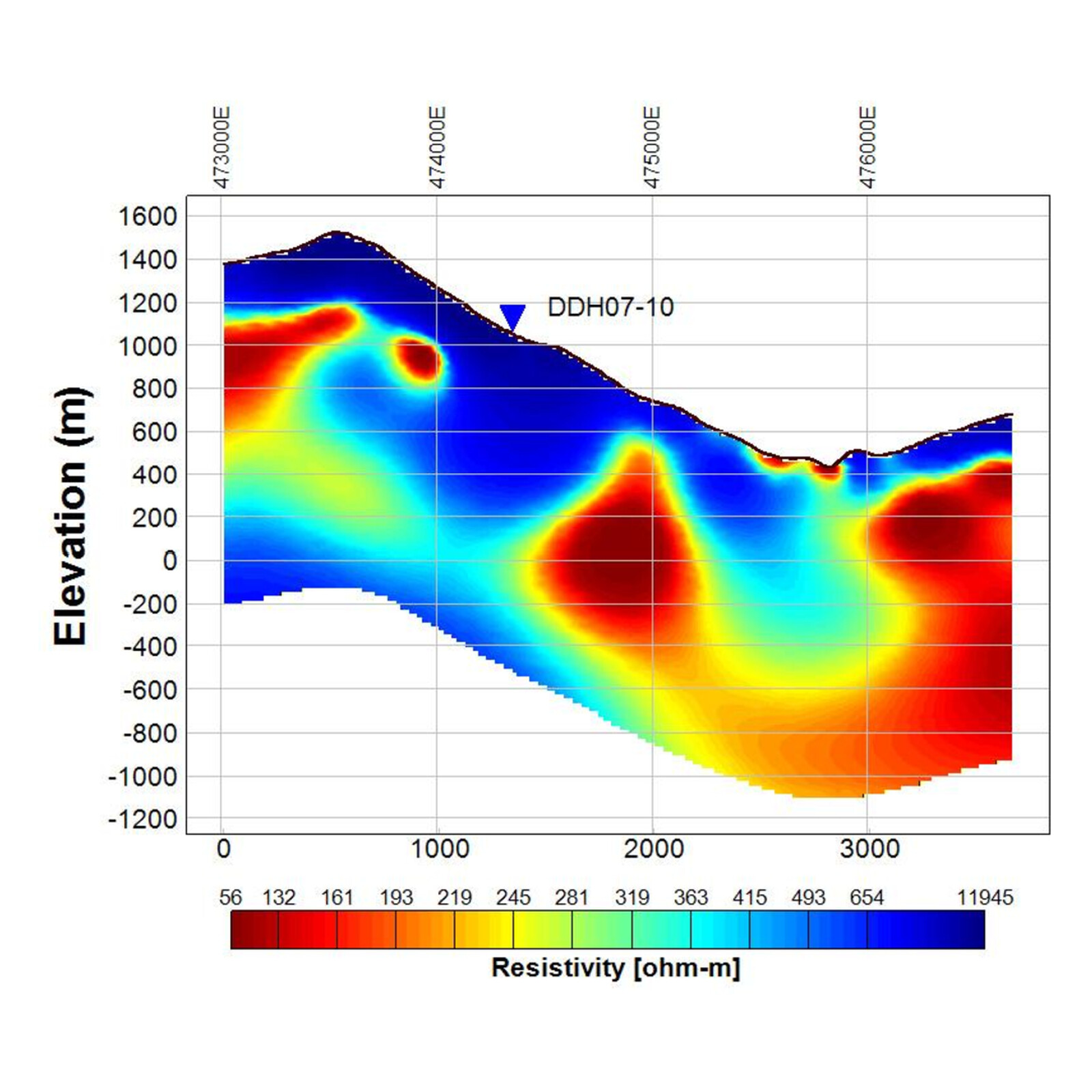
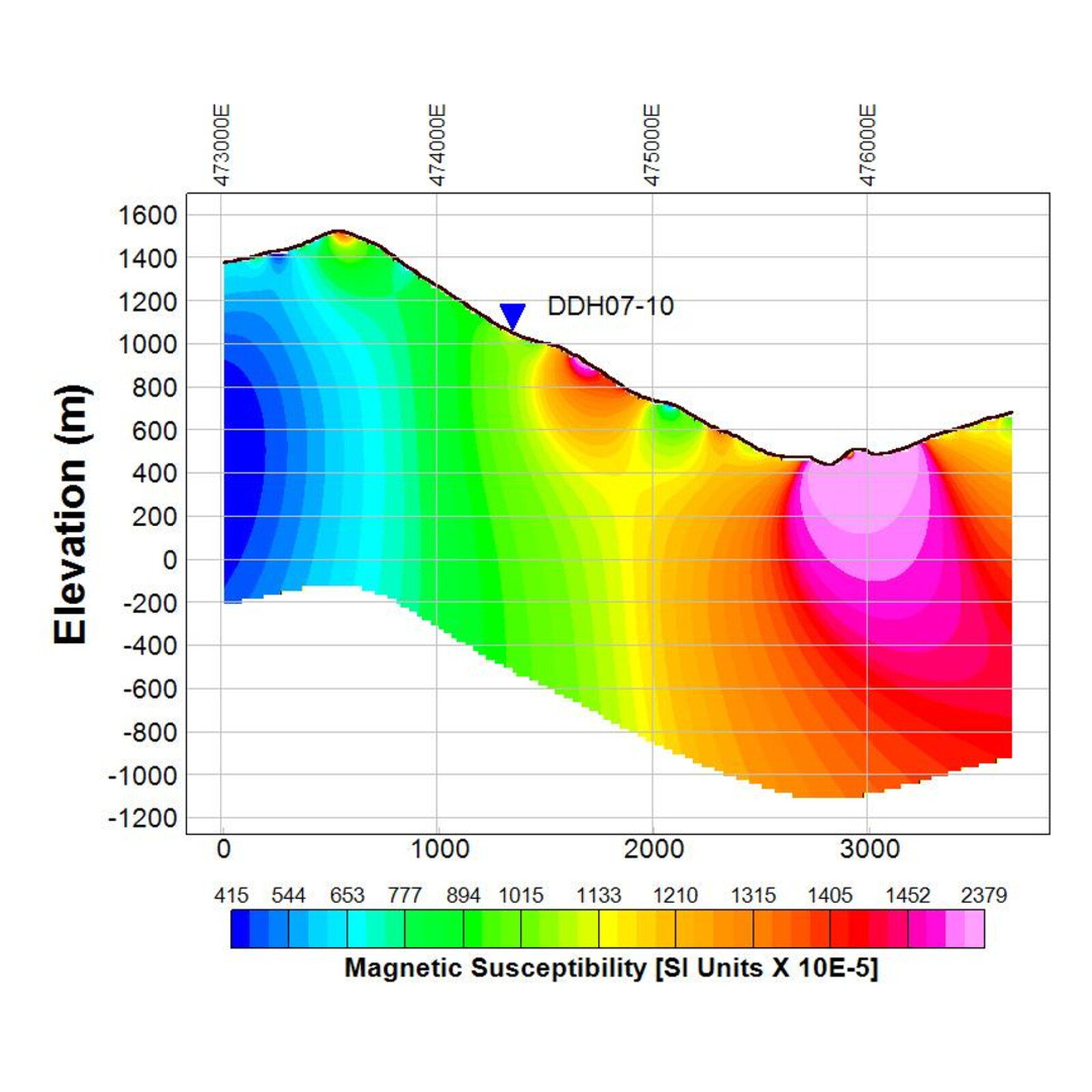
Line 1060 crosses the area of historic drilling and passes historical hole DDH07-10. This section and lines 1032 and 1092 open at true scale in the interactive map.
MobileMT is a passive airborne electromagnetic technique that records magnetic (in the air) and electric (on the ground) fields generated by natural sources in the audio frequency range. The natural electromagnetic primary field sources for MobileMT are considered with frequencies ranging from 25 Hz to 30 kHz (ELF+VLF). The exploration system includes two pairs of grounded electric wire lines, one of them is for reference signal, and moving three-component inductive coil system softly suspended and with low-noise signal amplifiers for magnetic field measurements (dB/dt) in three orthogonal directions. A crucial element of the technology is the capability of aerial acquisition magnetotelluric data in four decades frequency band. Field data are acquired using stationary orthogonal pairs of electrical field sensors (grounded wire dipoles) and towed magnetic field detectors (three orthogonal induction coils).

Survey data and report: Expert Geophysics Surveys Inc., October 2026.